Monday, September 03, 2007
The Charnwood Round
I decided against doing the Bullock Smithy Hike this weekend as a; it's a massive jump up in distance with quite a tough route, b; there is navigation work involved, and I'm notoriously sh*te at using a compass and c; I would have struggled to get there.
So I instead opted for the Charnwood Round anytime challenge walk I picked up a few years ago, and have been meaning to do ever since. There are opportunities for shortening the route, but I opted to do the full 33 miles. As there would be no check points, I had to take my own water and food- 3 litres of water, a lucozade drink and flask of coffee, so my pack was quite heavy (although it did lighten as the day went on!)
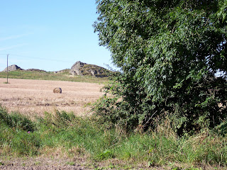
The route starts at Newtown Linford, a pretty stone village at the end of Bradgate Park (childhood home of Lady Jane Grey). It was a lovely morning as I left the village and walked through the fields, the dew soaked my running shoes. I decided to wear these as wearing walking boots over this kind of distance just knackers my feet.
 Field near Newtown Linford
This was part of the Charnwood Marathon I did in March, but in reverse. I made my way up the road to the impressive ruins of Ulverscroft Priory (much of which were under some kind of plastic covering).
 Ulverscroft Priory
From here, the route went through the busy hamlet of Copt Oak before a long gradual ascent towards Bardon Hill.
 Old Rise Rocks
  Longcliffe Hall
 Beacon Hill And The 'Devil's Profile'
So I instead opted for the Charnwood Round anytime challenge walk I picked up a few years ago, and have been meaning to do ever since. There are opportunities for shortening the route, but I opted to do the full 33 miles. As there would be no check points, I had to take my own water and food- 3 litres of water, a lucozade drink and flask of coffee, so my pack was quite heavy (although it did lighten as the day went on!)
The route starts at Newtown Linford, a pretty stone village at the end of Bradgate Park (childhood home of Lady Jane Grey). It was a lovely morning as I left the village and walked through the fields, the dew soaked my running shoes. I decided to wear these as wearing walking boots over this kind of distance just knackers my feet.
 Field near Newtown Linford
This was part of the Charnwood Marathon I did in March, but in reverse. I made my way up the road to the impressive ruins of Ulverscroft Priory (much of which were under some kind of plastic covering).
 Ulverscroft Priory
From here, the route went through the busy hamlet of Copt Oak before a long gradual ascent towards Bardon Hill.
 Old Rise Rocks
I didn't go up the the summit of Bardon Hill (it was off route and not part of the mileage). Although it's the highest point in Leicestershire, there were apparently paths leading over the summit and a large deer park at one time. Now, sadly, it's just a shell as most of it has been quarried away. From the trig point marking the summit, the view beyond is just vast expanses of quarry.
I made my way through the edge of Coalville and up through the lovely permissive path over the rocky Warren Hills. As I stopped for a coffee and biscuit (bit of luxury!) it clouded over which was a shame. The route then dropped down to Mount St Bernard's Abbey, which is a modern order so still in use. The route takes an 8 mile loop back to this point, so I set off over Blackbrook Reservoir and up to the woods and deserted railway track near Shepshed. I remembered that there has recently been a (genuine!) panther sighting here by an off duty policeman out running.
The route then dropped down by the furthest point of the reservoir, and it was here I saw something strange; a dead fox, but twisted as though it had died in agony. Bits of it had been torn away and it had been mostly eaten, down to the bone on tail and paws. I'd never seen anything like this before, could have been a dog but you never know...
I stopped for lunch in a field and then had a mile of road walking. This was new territory for me so was quite interesting, although I nearly missed the next footpath. This took me through woods, I was a bit concerned as there were lots of different paths leading off, but I used my judgment and emerged on the road in the right place!
The route touched the town of Whitwick before turning back towards Mount St Bernard's Abbey; the path skirted a quarry, apparently there was a volcano here which erupted over 570 million years ago, and they are blasting the original core.
Once back at the Abbey there was a mile of road walking to the tiny hamlet of Oaks In Charnwood, before a climb to the top of Lubcloud. It was quite windy at this point and started to spit with rain, but didn't come to anything. This was also part of the Charnwood Marathon, and I dropped down to walk under the M1 before climbing to the road to Nanpantan. This wasn't very pleasant as it was road walking, and it's amazing the number of cars who refuse to slow down or move over at all for walkers!
A permissive path I'd not used before took me over a small, rocky promontory called Buck Hill, which had quite impressive views over Loughborough and Longcliffe Hall.
 Longcliffe Hall
A walk along the ridge and descent and trudge along the valley floor brought me to the ascent to Beacon Hill. My legs were aching a bit at this point, and once I'd climbed to the trig point, I rested for a few minutes and ate my remaining roll. A long gradual descent (which I jogged) took me to Woodhouse Eaves, where I met an old gentleman pushing his bike. He explained he couldn't make the hill, as he'd done half an hour on his rowing machine as well, and asked me how far I was walking. He seemed amazed when I told him!
 Beacon Hill And The 'Devil's Profile'
A nice easy route took me through Woodhouse to Quorn, the whole route to Bradgate Park was now following the Charnwood Marathon route in reverse. The path from Quorn follows the stream and is quite narrow, and I was most preturbed to round a bend and come face to face with a massive red and white bull with large horns, right in the middle of the path! Luckily it was very docile, and just watch me.
As I reached Swithland woods, it started to rain. I passed through the woods, as quickly as I could as the soles of my feet were burning a bit and I just wanted to finish. A walk across a huge meadow field brought me to Bradgate Park, and I followed the tarmac path running through the Park to Newtown Linford. This is a drag at the best of times, and the rain decided to really go for it (where is this Indian summer we were promised!?!) My mate rang, and it was quite good to be able to chat as I was walking, but by the time I got back to the car I was soaked as I decided I couldn't be bothered to put waterproofs on!
My lovely mum had saved me a Sunday dinner, which was very very welcome... my legs were aching a bit, but not too bad, I'm just a little stiff. The soles of my feet are a little sore still and I have a blister, but all in all, I'm in pretty good shape. The walk took me 11 1/2 hours, which is quite slow, but I wasn't rushing, I just wanted to do the distance with a decent pack weight, and it's all time on the feet.
At least the rain won't be a problem in the desert!!
Labels: challenge, Challenge walks, Charnwood Marathon, Charnwood Round
Comments:
<< Home
Sounds like a route I devised and have been using for 30 years, but starting and finishing in Loughborough, including Bardon Hill summit, the Outwoods and the nice path from Woodhouse Eaves to Old John, and with less messing about round Blackbrook Reservoir. You might like to know, Steph, that there's a permissive path from where the footpath from Longcliffe Farm reaches the dreaded Nanpantan Road direct to the upper valley of the Wood Brook. It leaves out the lovely Buck Hill ridge, but is a whole lot safer! I can give you the detailed route, beginning and ending at Loughborough Midland Station if you like. Colin Price, former Loughborough resident.
Post a Comment

<< Home
![]()
